Forts in Bhimber
Padhar and Batala, reconstructed from field photographs and satellite images.
People picked up a lot of things during COVID. I picked up a quest to document every fort in Pakistan.
It ended up becoming a catalogue of 174 different sites, which is the largest catalogue of forts in Pakistan. I published most of it on Twitter, alongside other threads I wrote on the architecture and fortresses of the subcontinent. The project was shared pretty widely and ended up reaching people I definitely did not expect when I started it.
Twitter is also a pretty bad place to leave something like this long term. So I wanted to preserve at least part of the project here.
Probably the contribution I am most happy about are two forts in Bhimber district that I was able to document which had never previously been documented. That is not the same as saying they were unknown to locals. People around them obviously knew they existed. But before I published them, I could not find any photographs of either fort online, or anything written about their history, architecture, or surviving remains.
A special thanks to my uncle, Mian Ubaidullah, who was working in the electricity department in Bhimber District at the time and took the time to go with me to these places, sometimes when neither of us really knew what we were going to find when we got there.
Below are the two forts, what I saw of the surviving remains, and my attempt to piece together what little we can about their history and architecture.
Kila Padhar
My grandfather remembered having been there many years ago and passing through a gate that he thought belonged to an old fort. We had no idea whether anything still survived, or even whether his memory of it being a fort was correct, but it sounded promising enough that we decided to pay it a visit.
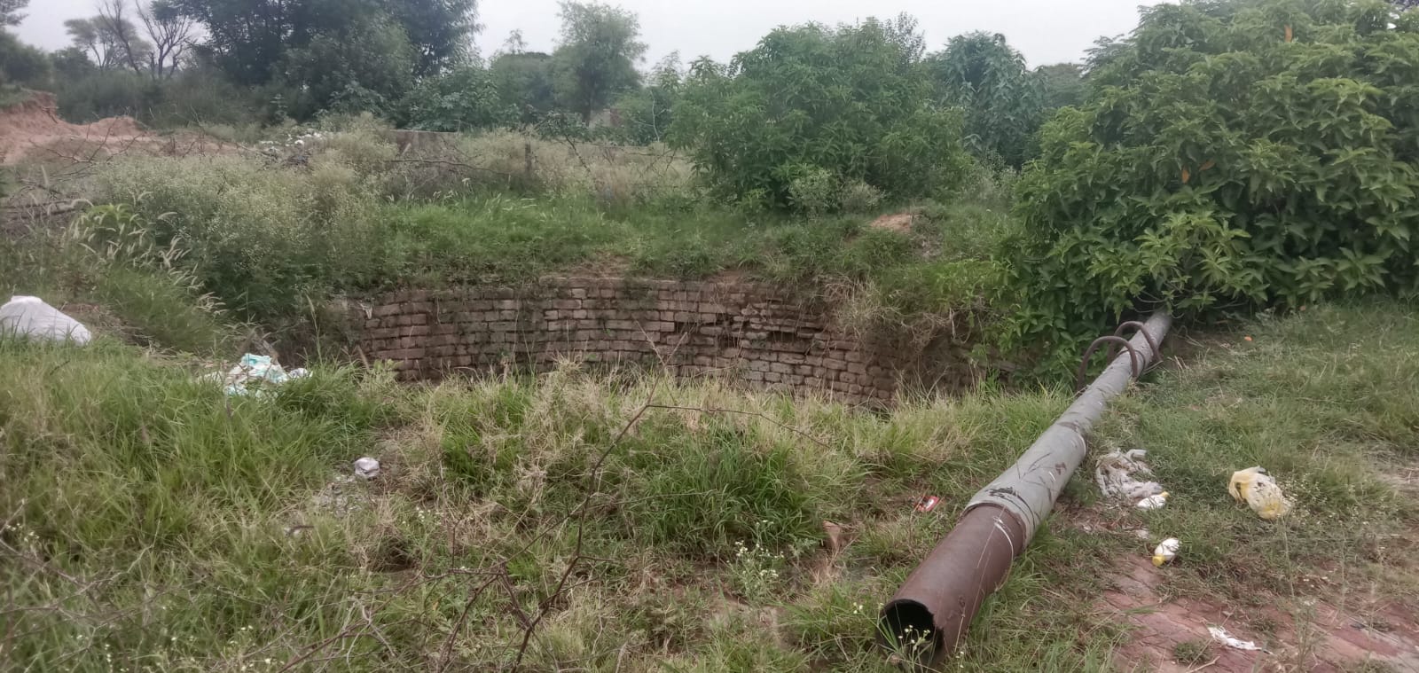
Padhar is a small village around ten minutes' drive from the town of Barnala, in Barnala Tehsil of Bhimber, at the southern edge of Azad Kashmir. Very little of the fort survives today. The most intact remains are the lower sections of one wall and part of what appears to have been the gatehouse. There is also a simple well inside the former enclosure which is still functional and was still being used when I visited.
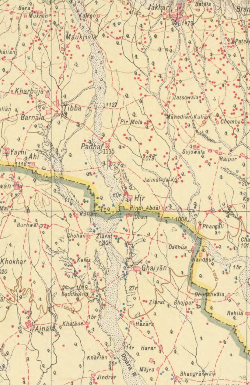
The 1921 map reproduced below marks Padhar beside an older channel of the Doara River.1
Local memory preserves more of the fort than its present remains do. People described four bastions, one at each corner, and remembered the well as an important source of water. Padhar lay on the old route between Jammu and Bhimber, and the availability of water seems to have made it one of the stopping points along that road.
The geography was also somewhat different when the fort was in use. Old maps place it beside a channel of the Doara River, on slightly elevated ground immediately above it. The river no longer follows the same course, but when it did, it would have provided a natural obstacle along the western side of the fort. The nearby village of Hir, around two kilometres away, also lay along this older course of the river.
Surviving walls
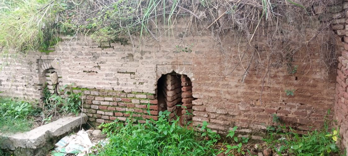
One of the strongest pieces of evidence that the remains at Padhar really belonged to a fort is the presence of triple-slit loopholes. An embrasure opens internally into three narrow firing slits, allowing fire to be directed at three different angles. This form appears repeatedly in forts across the lower hill zone, from Himachal and Jammu and further west towards Pothohar and Hazara. Lahore provides an example further south, so it is certainly not exclusive to the hills, but it is extremely common among the eighteenth- and nineteenth-century forts of this belt.
Seeing those loopholes was one of the things that made me much more confident that this was not simply the remains of an old walled compound. Whatever its exact date or function, the surviving wall had clearly been designed for defence.
The building material, on the other hand, reflects Padhar's position on the edge of the plains. The surviving masonry is made from thin baked bricks rather than the stone one increasingly encounters in forts further into the hills. The thin and long bricks are of the general size usually described as Nanakshahi, popular in the late Mughal and Sikh era. Padhar sits beside an old river system in an area with abundant clay, right where the stonier foothills give way to the alluvial plains.
Forts of the Punjab Hill States
Padhar sits at an interesting geographical transition. Go north and the country quickly rises into the lower hills of Jammu; go south and it opens almost immediately into the plains around Gujrat and Sialkot. It also lies very close to the Punjab–Kashmir boundary demarcated after the First Anglo-Sikh War, when Captain James Abbott worked through this region in 1847 to fix the frontier between the Lahore State and the newly established Dogra kingdom of Jammu and Kashmir.2 Before this division, the area had formed part of the Chibh state of Bhimber, whose territory extended considerably further south than the present boundary.
That position is useful for understanding the fort, because although Padhar itself is on relatively flat ground, what survives looks much more like the forts of the hill belt immediately to its north and east than the forts one encounters further into Punjab.
I am using “Punjab hill zone” fairly loosely here, rather than as a precise political term. Hutchison and Vogel, in History of the Panjab Hill States,3 use the Punjab Hill States for the chain of small states running through places such as Bhimber, Poonch, Rajauri, Jammu, and the hill states further east into present-day Himachal. I am using the term somewhat more broadly for an architectural zone extending westwards into Pothohar and Hazara as well.
Forts across this belt are not identical, but certain features recur often enough to suggest a common architectural vocabulary, including relatively thin brick or stone curtain walls, octagonal bastions, triple-slit loopholes and small crenellations. There is no hard boundary, but this combination of features becomes less common in the plains of central and southern Punjab.
This architectural vocabulary appears to belong largely to the period between the decline of Mughal power after Aurangzeb's death in 1707 and the fall of the Sikh Empire in 1849. Older forts in the same region, such as Pharwala and Mahorgarh, do not generally share it. How the older tradition of much heavier earthen fortifications developed into forts of this later type is a separate subject in itself.
Plan and bastions
Satellite imagery gives a rough width of about 70 metres for the former enclosure. Given the surviving alignment of the walls, and the generally regular plans of forts built on relatively flat ground, the simplest reconstruction is a roughly square enclosure of approximately 70 by 70 metres.
The people I spoke to consistently remembered four large bastions, one at each corner. Unfortunately, none survives well enough for us to determine its original shape.
My guess would be that they were octagonal.
That is not because there is anything in the surviving masonry that proves it. It is simply the most common form among comparable forts immediately around Padhar. Octagonal bastions appear again and again across forts in the Punjab hill zone, while circular bastions become much more common as one moves further south onto the Punjab plains, though there are obvious exceptions, such as Sheikhupura Fort. Given both its location and the rest of its architectural vocabulary, octagonal bastions therefore seem the more likely reconstruction.
Gatehouse
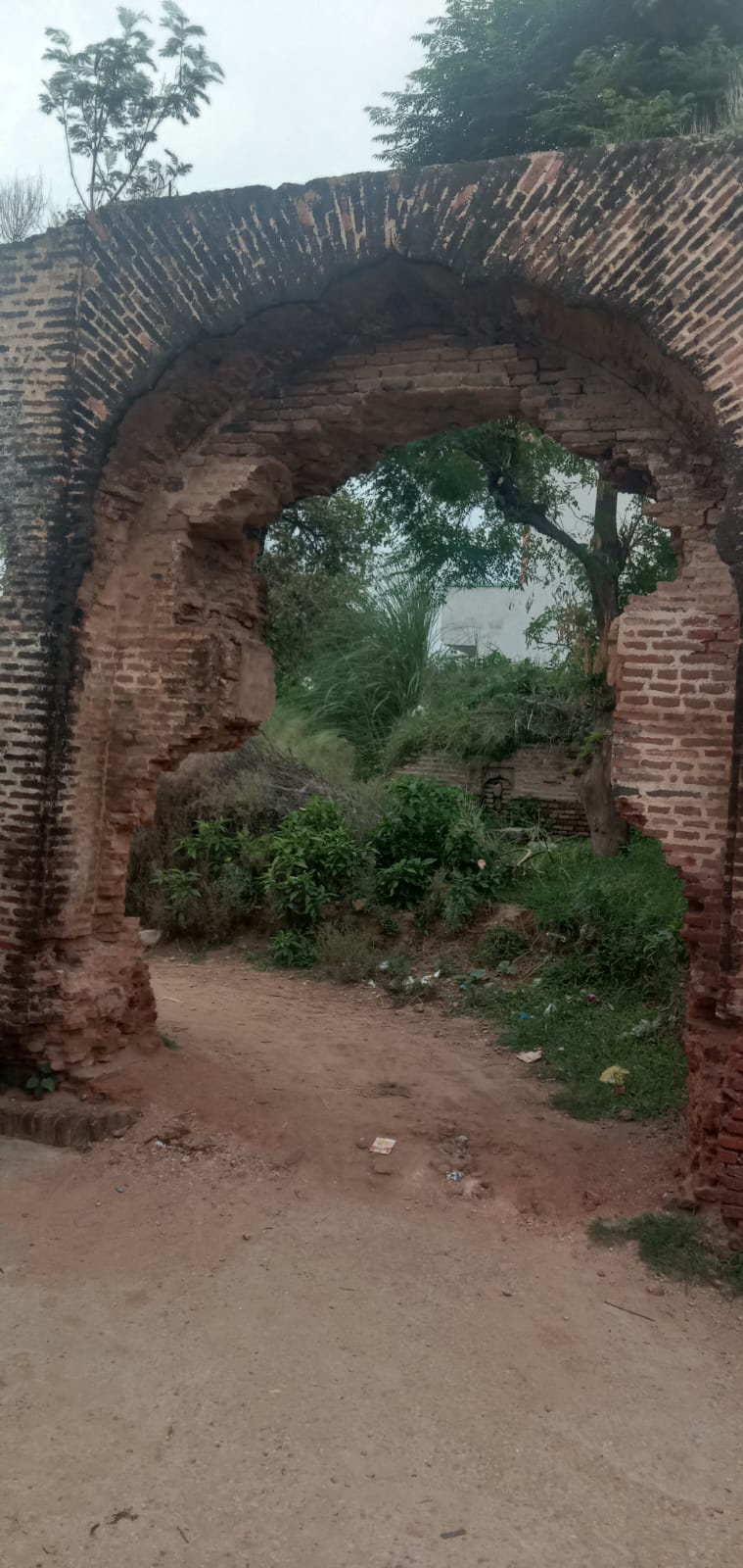
The most interesting surviving part of Padhar is what I think was the gatehouse.
Across much of the Indian subcontinent, fortified entrances were designed to avoid providing a straight, unobstructed passage into the enclosure. Gates were often approached at an angle or arranged so that anyone entering had to make a sharp turn, while successive outer and inner gates created additional obstacles before the interior could be reached. The basic defensive principle was simple: slow an attacker, break the momentum of a direct assault, and expose anyone passing through the entrance to defenders above or alongside them. What varies considerably from fort to fort is the way this was achieved.
At Padhar, the closest comparison I have found is at Baral, where a square gatehouse projects outward from the fort and forces anyone entering to make a sharp perpendicular turn before reaching the enclosure.
The main difference is its position. At Baral, the gatehouse occupies one corner of a very small fort and effectively replaces the corner bastion. The fort itself is constrained by the edge of a hill, so the arrangement makes immediate sense: the terrain already limits the approach and helps force anyone entering into a sharp turn.
At Baghsar, the same basic problem is solved differently. A perpendicular entrance is protected by a full-sized bastion on the outer side of the approach, narrowing the passage and allowing defenders to fire along it from either flank. At Ramkot, by contrast, the outer gate opens through the curtain wall, with the gatehouse and inner entrance set behind it inside the fort.
Smaller mountain forts such as Throtchi and Karjai can rely even more heavily on the terrain. Where a fort is squeezed onto a ridge, hilltop, or the edge of a steep slope, the approach can be made to run between the wall and the cliffside before turning into the entrance. The geography itself therefore does much of the defensive work, reducing the need for a large projecting gatehouse simply to force a bend in the approach.
Padhar is different from all of these. Its gatehouse appears to have projected outward from the middle of one side of the fort rather than occupying a corner, while the main curtain wall continued beyond it. This can still be inferred from the surviving remains and from older satellite imagery. The surviving opening appears to be in the side of that projection. A turn into the enclosure is therefore my best reconstruction, but the inner opening and complete passage do not survive clearly enough to establish the arrangement.
There are closer parallels further into Jammu. Bahu Fort and Ramnagar Fort in Udhampur also have projecting rectangular gatehouses without the full-sized flanking bastion seen at Baghsar. Instead, their entrances are accompanied by much smaller buttresses.
Buttresses
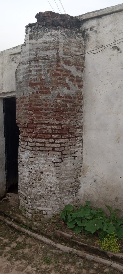
Three small octagonal buttresses, each around three feet across, survive along the gatehouse’s outer face. Similar forms appear at Kaleeth, Bahu and Ramnagar, as well as at Kila Sheikhupura further south. Their shape alone does not tell us whether they were principally structural or ornamental.
Their position is more suggestive. At Bahu and Ramnagar, buttresses flank the entrance and also occur along ordinary stretches of wall. At Padhar, the surviving examples are attached to the outward face of the projecting gatehouse, along the wall parallel to the main curtain wall, rather than framing the entrance itself. Parts of this face have since been incorporated into houses, but the three projections can still be made out, including on satellite imagery.
That arrangement is why I favour a structural explanation over one based primarily on ornament. The buttresses seem to reinforce the projecting chamber rather than emphasise the doorway. Baral provides a useful comparison: its projecting gatehouse achieves a bent entrance without comparable buttressing, so the defensive arrangement alone does not explain their presence at Padhar.
I could not identify comparable buttresses along the surviving curtain wall, although so little remains and so much brick has been stripped that their absence cannot establish the original design. My best guess, based on the remains, is that the gatehouse carried greater weight or rose higher than the surrounding walls. Ornament may also have played a part, and the lower portions that survive cannot establish its original height or number of storeys.
What happened to the fort
Based on interviews I conducted in the village, Padhar in its present form largely dates from after 1965. Refugees who had migrated from the Poonch-Rajouri region settled here, as they did in a number of places across Azad Kashmir. With little in the way of resources or building material available to them, the abandoned fort became part of the new village. Its bricks and walls were gradually cannibalized for construction, while portions of the northern side of the gatehouse were incorporated directly into houses. This continued until surprisingly recently. According to satellite imagery, the western wall of the fort survived until around 2013, when it was removed to create an Eidgah, an open-air prayer ground.
Dating
Unfortunately, none of this tells us exactly when Padhar was built. It could belong to the eighteenth century, when the region around Bhimber and Jammu was politically fragmented and a local chief might plausibly have fortified a road or river crossing. It could also have been a Dogra fort or later used as one, perhaps connected to administration or revenue collection.
The architecture only narrows it to the broader eighteenth- and nineteenth-century military tradition of the region. Its triple-slit loopholes, likely bastion plan, brick construction and projecting gatehouse all fit comfortably within the forts of the Jammu and Punjab hill zone, but none is precise enough to date it.
Kila Batala
Kila Batala, also known as Kila Ranbirgarh, occupied a ridge above the village at the foot of the hills. Little of it survives.
I first heard about it from a colleague of my uncle, who mentioned that there had once been a fort above the village. Batala sits at the base of the foothills, where the ground becomes steeper and rockier.
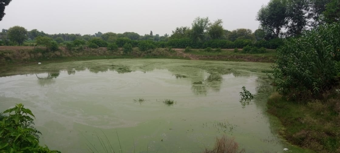
There are several chappars—ponds that collect seasonal water—in the area, formed where streams coming down from the hills converge. Some have stone or other pucca sides, meaning permanent masonry rather than bare earth, suggesting they were deliberately constructed. The area also has old mango orchards, many of them predating Partition.
The present village, like Padhar, was largely settled by refugees after 1965. According to people I spoke to, much of it was built using stone taken from the older settlement that had existed there before. That earlier settlement was remembered as predominantly Hindu, considerably larger, and containing a school. It lay along the lower slopes, while the fort stood further above it.
Near the bottom of the hill I noticed a retaining wall made from thin brick and stone. Further up, the slope became heavily overgrown, though there also seemed to be a short run of steps cut into the rock leading towards the flatter ground above.
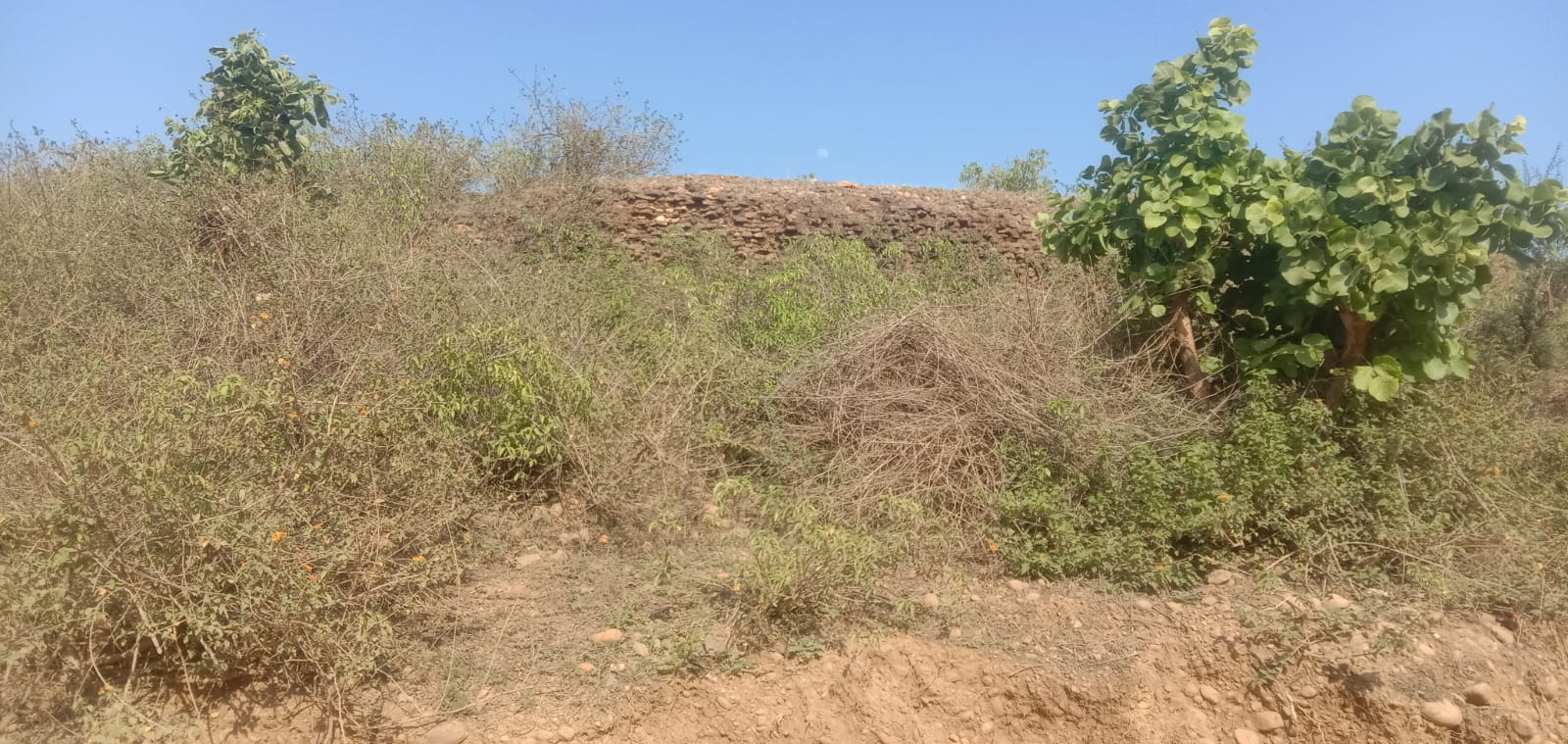
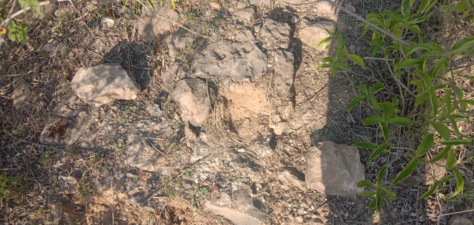
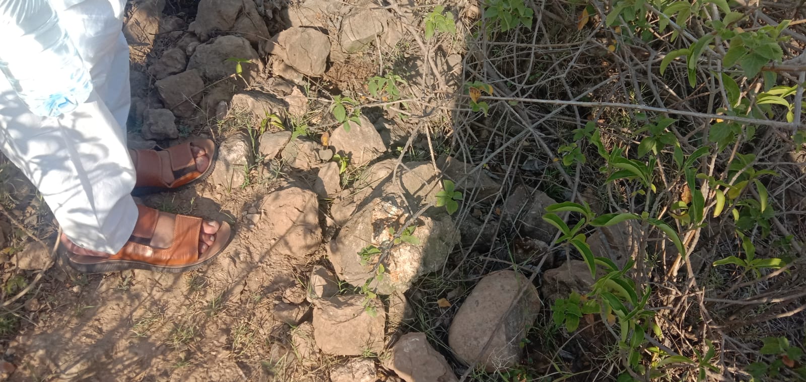
Near the top of the ridge, the terrain opens into a relatively flat patch. Here we found worked stone and brick scattered across the surface, some still mortared together. The clearest surviving feature was what appeared to be the foundation of a substantial wall, around three feet thick, running across the ridge. Near the cliff edge was a concentration of masonry which may have marked the base of a bastion. The remains were too fragmentary to establish its original outline.
From the surviving remains and satellite imagery, the fort seems to have been roughly square and around 40 metres across, occupying most of the flatter ground near the top of the ridge. The foundation may survive simply because it was much harder to dismantle and reuse than the standing walls. The plan below uses octagonal corner bastions 5 metres across and a 3-metre central entrance as illustrative assumptions, not measurements of surviving features. The LoC (Line of Control), shown approximately 2.5 kilometres north, is a present-day geographical reference rather than part of the historical reconstruction.
Much of the hill has since been dug up for gravel, so further remains may already have been destroyed. I also did not come away with particularly good photographs: the light was extremely harsh, while much of the site itself was in deep shadow and vegetation.
There is too little surviving architecture to date the fort closely, but my guess is that it was probably a Dogra-era fort, built for administration or tax collection. Its position above an established settlement, close to water and cultivated land, would fit that role well.
Given how much of the ridge has already been quarried away, even what survives seemed worth recording.
Conclusion
Later, when I came across the 1921 map of the area, I realized that Padhar and Batala were the only fortifications in Barnala Tehsil marked there that I had not already documented. Between these visits and the forts I had covered earlier, that effectively accounted for every fortification in the tehsil shown on the map.
Much of this survives through local memory. People usually know where the old walls were, which hill had a fort, or where building material was taken from. The ruins are often not unknown at all; they are simply undocumented. That makes the work less about “discovering” places and more about recording what is still there before even less survives.
Footnotes
-
Survey of India, India 1:126,720, sheet No. 43 L/N.W., 1921. Catalogued as “Jammu, Mirpur, Gufranwala, Gufrat and Sialkot Districts, Kashmir & Jammu & Punjab No. 43 L/N.W. 1921.” American Geographical Society Library, University of Wisconsin–Milwaukee Libraries, Digital Map Collection, digital ID am009701c. View the map and catalogue record. ↩
-
Journal of Captain James Abbott, Boundary Commissioner, April 1847, in Journals and Diaries of the Assistants to the Agent, Governor-General, North-West Frontier and Resident at Lahore, 1846–1849 (Punjab Government Records, 1911). ↩
-
J. Hutchison and J. Ph. Vogel, History of the Panjab Hill States, 2 vols. (Lahore: Superintendent, Government Printing, Punjab, 1933). Vol. 1, Vol. 2. ↩